HYDROpro Navigation Test with Sentinel SuperPro Dongle Clone or Emulator.
HYDROpro Navigation
Trimble’s HYDROpro™ Navigation software is an easy-to-use software solution for today’s hydrographic surveyor. Designed with superior performance and efficiency in mind, it allows for significant improvements in productivity on even the most complex marine survey application.
Marine Survey and Construction Software
Trimble’s HYDROpro™ Construction software is a comprehensive software package for marine and waterway construction tasks that require precise positioning. With the HYDROpro Construction software, projects can be completed faster, safer, and more economically than with conventional methods.
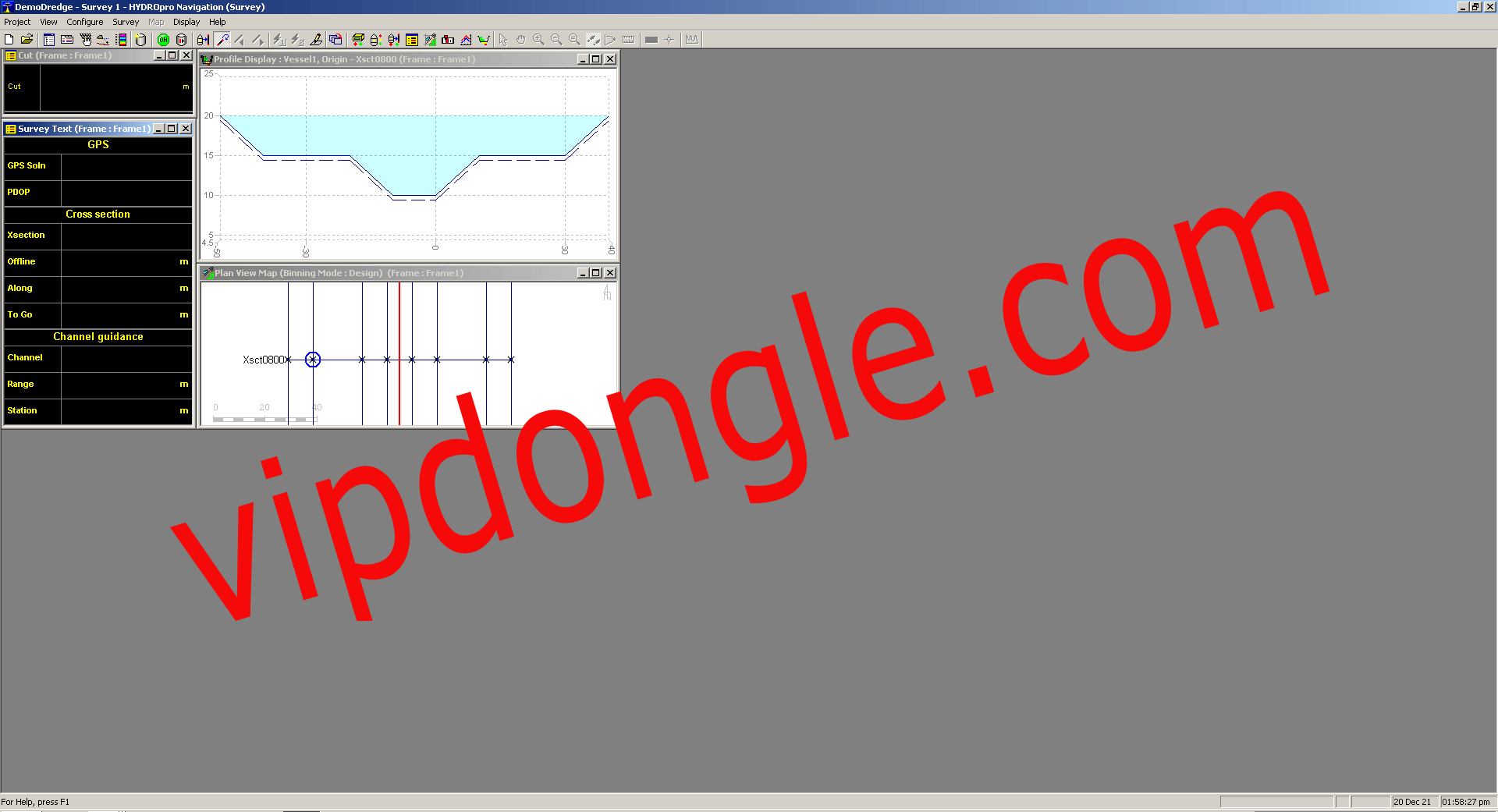
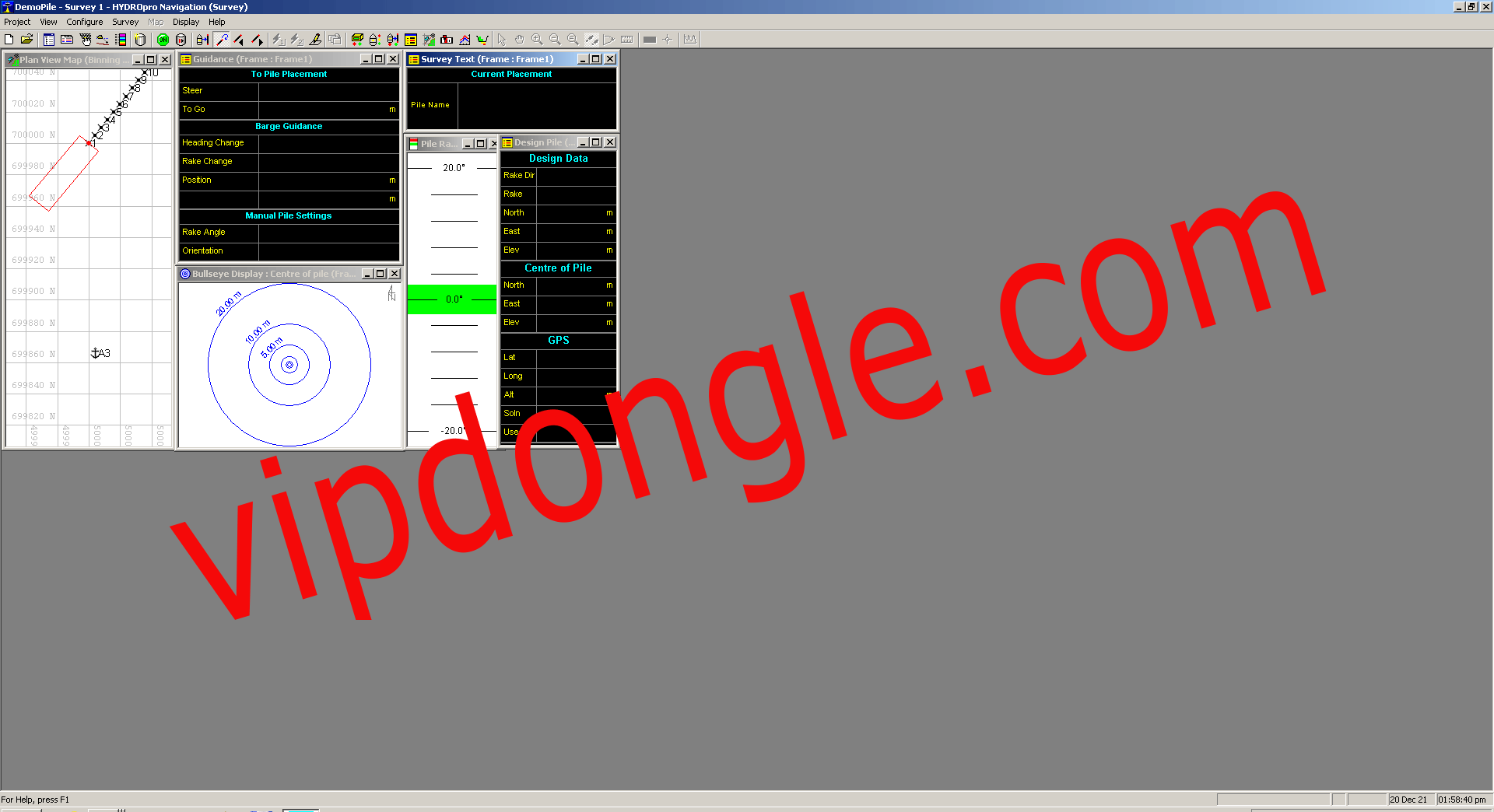
The software builds on the patented and proven techniques of the Trimble HYDROpro Navigation software. It encompasses all of the hydrographic surveying features offered in HYDROpro Navigation, plus multiple ‘flavors’ for specific marine construction applications, namely Pile, Rig, and Dredge.
Multiple software flavors for specific applications.
The Rig flavor enables you to position and manage tugs, rigs, and barges. You can view the vessel image at your target location and use bullseye displays for precise guidance. Once in position, you can carry out final positioning with real-time statistics, and print a text report or export your data to a spreadsheet for further analysis.
It is an easy-to-use, configurable software for the synchronization of all equipment used in today’s hydrography surveys, real-time positioning of each of its own data, three-dimensional synchronous data collection, graphic/numeric real-time operation, and captain navigation, and can be configured in many different ways according to the requirements of the project.
In large operations, there are different modules that can be used for a wide variety of purposes for the coordination of all operational units, following each other, such as barge/ship positioning, for example, routing of anchor-laying tugboats from a single-center, accelerating the work with very high daily operational costs.
The HYDROpro NavEdit module integrates seamlessly with the HYDROpro Construction software. With it, you can graphically filter and edit depth and tide data.